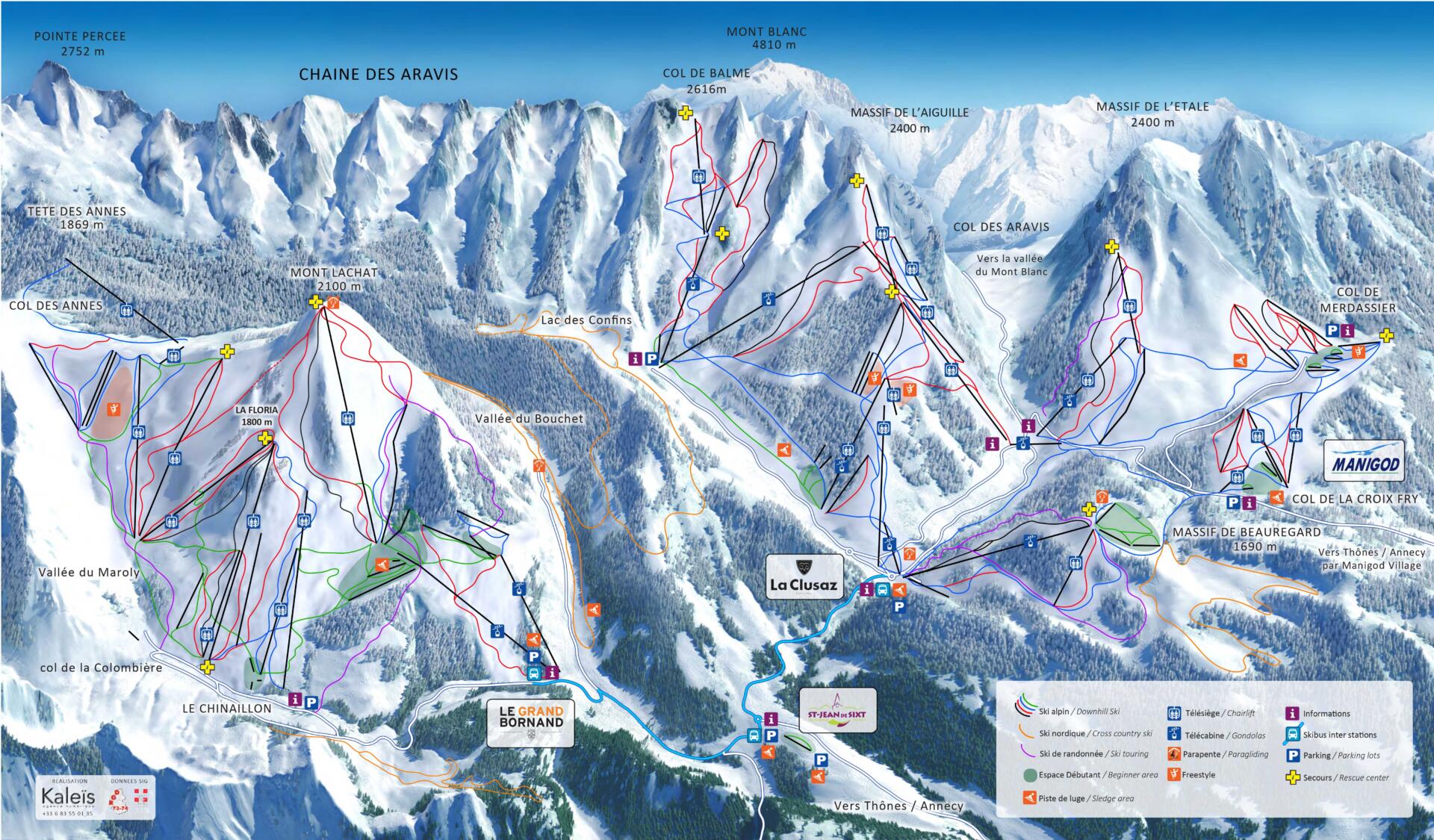
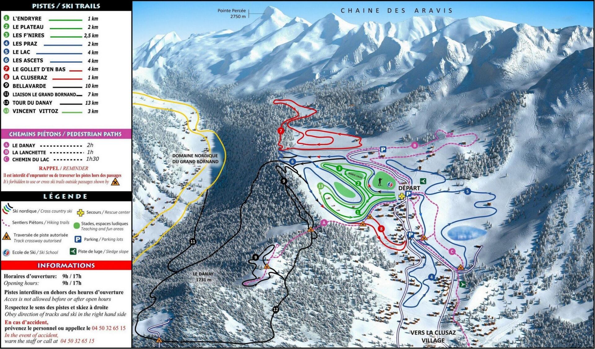
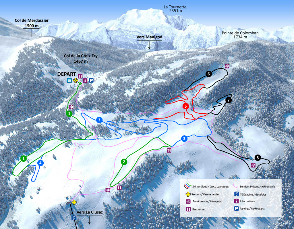
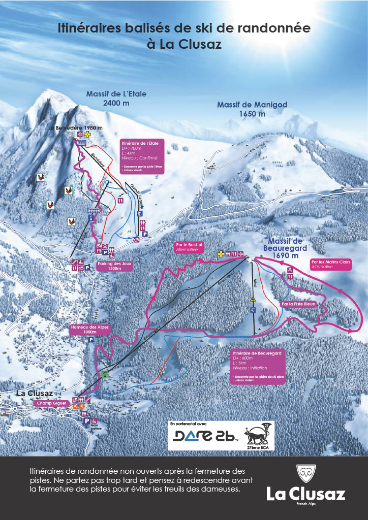
Discover all our alpine skiing, cross-country skiing, and backcountry skiing trails, suitable for all levels. Use our interactive map to explore the area and make the most of your ski day.
Alpine Skiing
LA CLUSAZ – MANIGOD
- 1 100 m – 2 600 m altitude
- 5 massifs
- 85 runs (8 black, 30 red, 31 blue, 16 green)
- 49 ski lifts
- 125 km of slopes (210 km Aravis area)*
- Fun zones: 1 snowpark, 1 Family Run and 1 Reblochon theme run
You can also consult the interactive map of the open slopes updated by the slopes service.
ARAVIS SKI AREA
The Aravis ski area includes the resorts of La Clusaz, Le Grand-Bornand, Manigod, Saint-Jean-de-Sixt (shuttle connections between the resorts) with 133 trails and 211.25 km*.
* According to the recommendations of Domaines Skiables de France, the mileage corresponds to the length of the slopes measured in the middle of the slope, increased by 30% to take into account the trajectories taken by the skiers. It is a measure consistent with that provided by GPS and smartphone applications used by skiers.

Cross-Country Skiing
LES CONFINS
- 53 km of trails, including a 7 km connection with the Nordic area of Grand-Bornand
- Children’s garden/Club des Pioupious nordiques
- Nordic Cross: playful and technical course open to all
- Laser biathlon
- Nordic Ski Park (Slalom, Tunnel, Jump, Loom, Ski Ball, Ski Hockey)

PLATEAU DE BEAUREGARD
36 km of trails, 8 trails


